
Drone Property Photography – Round Mountain, Texas

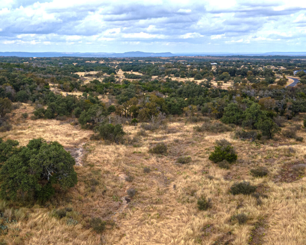
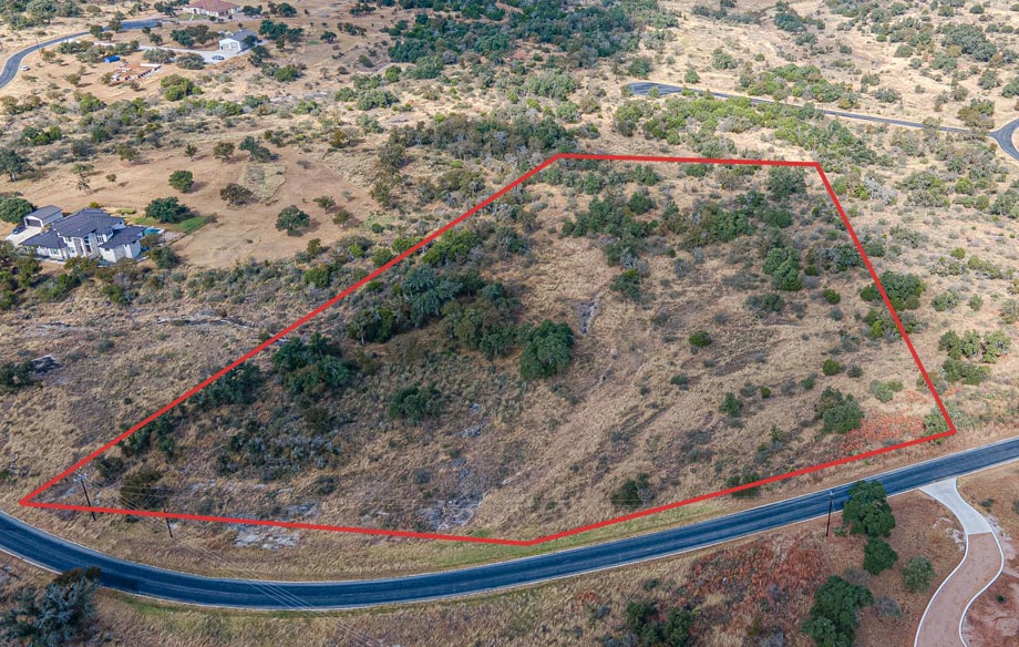
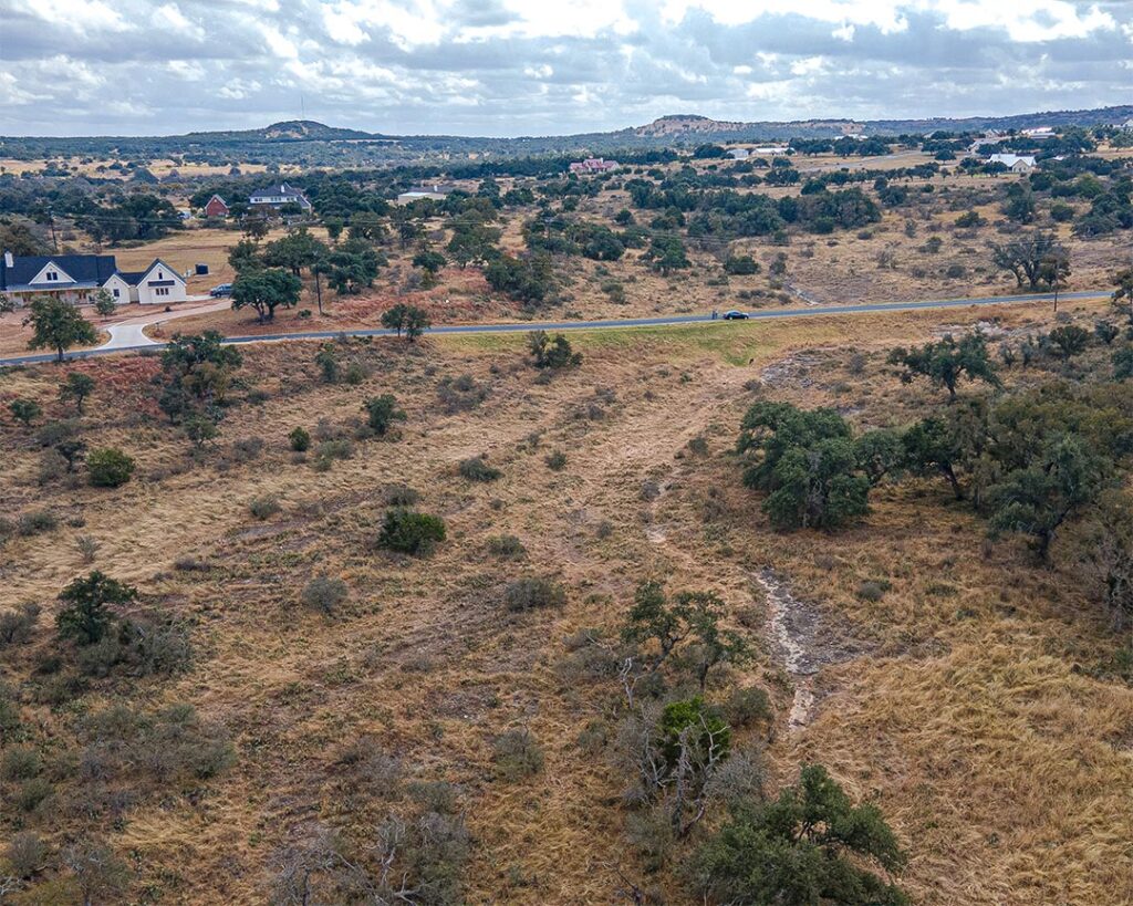
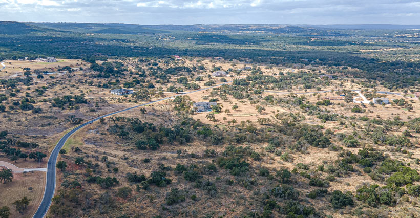
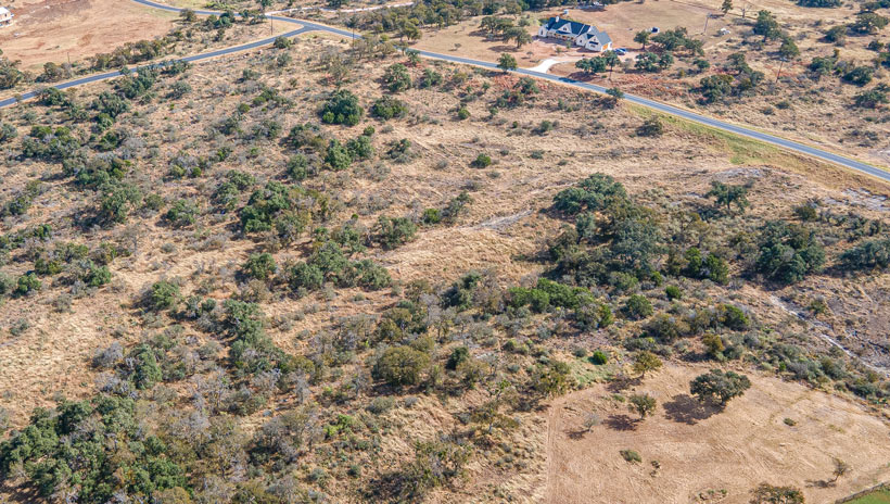
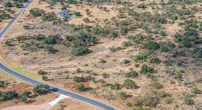
The drone property photography job on October 29th, 2024 – was in the beautiful gated community of The Bluffs at Round Mountain, Texas. Located just five minutes outside of Round Mountain, Texas, The Bluffs is a premium gated community nestled off Ranch Road 962 West. The land for sale is a spacious 5.02-acre property with beautiful views of big Texas hills in the distance. Stacey Zellner – a Texas real estate expert, aimed to refresh the listing with high-quality, updated images to attract potential buyers on real estate platforms. How D Media’s Texas drone photography services offer complete visual coverage, capturing the property from multiple angles and heights. We also focus on surrounding landmarks and natural beauty—highlighting features like hills, mountain views, rivers, lakes, parks, or nearby amenities to enhance appeal. Below, you can view previous images of the land, which were outdated and didn’t convey the property’s true potential.
This real estate photography shoot also included professional photos from the best photographer in Austin, Texas, – Philip Rogers. He is an expert photographer with over thirty years of experience taking photos and editing photos. From our experience, combining my drone photos with his interior and exterior ground-view photos overdelivers on the clients expectations.
Drone Photography Service Form
Please fill out the below form for me to email you directly. First, I’ll need the address that you’re interested in getting drone photos. Second, I’ll have to check my FAA database to see if that location is in a restricted FAA drone flight area. If so, I’ll send you a screenshot showing the restrictions. If in a restricted area, I’ll need to submit a request to fly in that are directly with the FAA.
Drone Property Photography Before How D Media
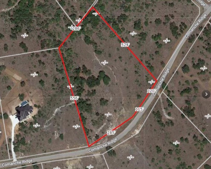
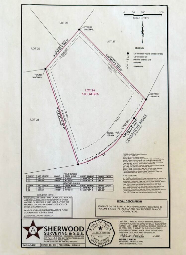
How D Media’s drone property photography services provided a game-changing solution for this realtor. Lacking professional visuals to showcase the property on listing websites, she turned to our team for help. Before working with us, her only available assets were an outdated aerial photo and a basic land surveyor’s document that outlined the property boundaries. As can be seen below, these limited materials failed to capture the full appeal and value of the property – leaving potential buyers unimpressed.
Property Drone Photography
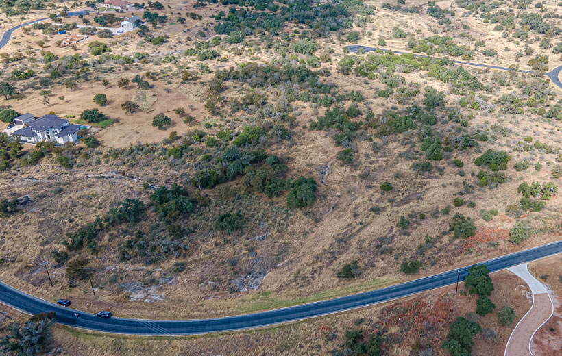
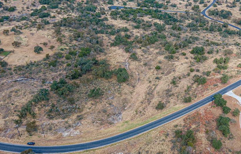
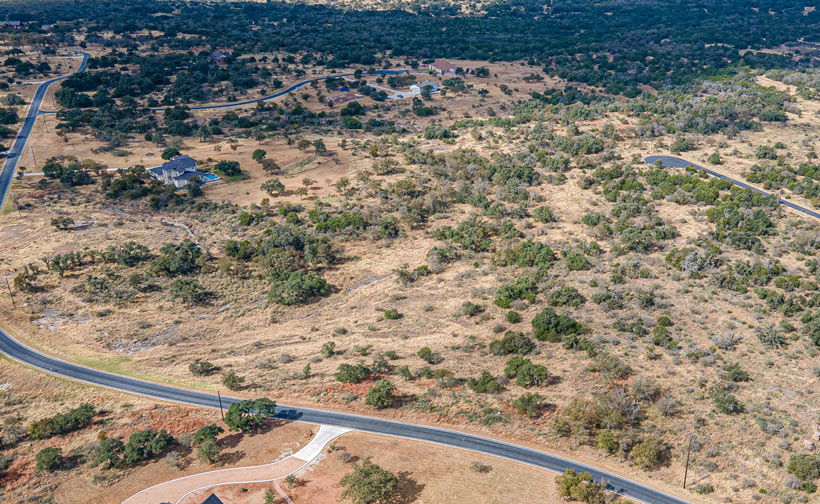
Below you can view more of the property drone photography images taken by myself and edited by Philip Rogers. Some of these photo show the property boundaries, some of the photos show the land for sale, and a couple of them show the potential views from a back or front porch. Do we charge extra to put property lines on our drone photos? Yes, for an extra $25 we will add property boundaries to two photos that you select. You also have the choice to receive the drone photos unedited, batch edited, or professionally edited.
Does Drone Photography Help Sell Real Estate Faster?
Drone photography has proven to significantly accelerate property sales for realtors by providing a unique, comprehensive view of both homes and land. With aerial shots, potential buyers can see exactly how a property or house looks from above, offering a clear perspective of layout, landscape, and surrounding features. I also run into people while taking drone photos that always mention how they only buy houses with drone photos.
-
According to MLS, properties with aerial drone photos sell 68% faster than those without drone images. (Source: NAR)
-
In 2024 about 35% of realtors used drones to market listings, which indicates a rise in drone photography usage among realtors. (Source: NAR 2024 Technology Report)
-
In the same report, about 22% of realtors indicated that they were very likely to seek advice or training on how to use drones, indicating an uptick in interest surrounding drones as emerging technology in real estate (Source: NAR 2024 Technology Report)